Fishing The Wild Coast
Not far from the comforts of modern life in the mining town of Nhulunbuy in north-east Arnhem Land in Australia’s Northern Territory – where the town ends – nature takes over.
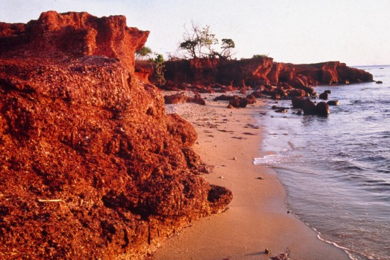
Just a few nautical miles out to sea, away from Nabalco’s alumina plant on Melville Bay, the landscape unfolds, monsoonal bushland hugs an endless coastline of orange/red to white sandy beaches, rocky points and outcrops and rich red bauxite cliffs – the same view Matthew Flinders saw in 1802 during his circumnavigation of Australia.
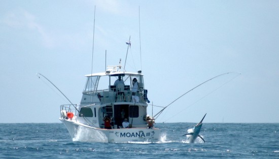
The islands, estuaries and rivers in the area are a magnet for passionate sports fishermen and divers. The warm, tropical waters are alive with coral and exotic and sought-after fish – barramundi in the estuaries and off the coast, barracuda, Spanish mackerel, black marlin, queenfish, coral trout, black jewfish, giant trevally and tuskfish.
Along with Bremer, Truant and Bromby Islands, dozens of other smaller outcrops dot the coast and past the strait called the Malay Road, named by Flinders after encountering a Malay fishing fleet there, the English Company’s Islands wrap around the coast to Arnhem Bay.
Further north-west, about 80 nautical miles from Nhulunbuy, the rocky finger of the Wessel Islands point into the Arafura Sea.
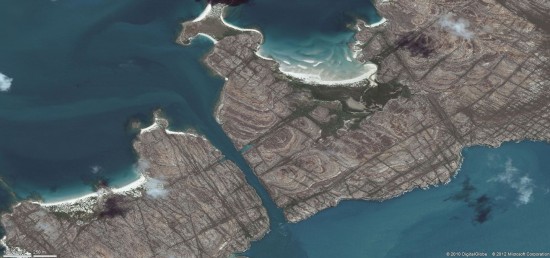
The run out to the open sea is not without its hazards, apart from the saltwater crocodiles which live throughout the islands, vessels from the earliest of times have negotiated the Hole in the Wall, known to the Aborigines as the Gugari Rip.
The 1.5km long, cliff-lined channel which separates Raragala and Guluwuru islands is little more than 100m wide at its narrowest point. It can only be negotiated by yachts and fishing boats when the tide is ebbing. When the tide is running, water surges through the rip at up to 13 knots. A day’s fishing out near Veronica Islet, about 12 nautical miles from the coast, and later at Bremer Island and East Woody Island closer to shore, yielded a grab bag of fish.
The weather was changeable, not uncommon for the Dry Season. The best time for fishing in Arnhem Land is from October to February, during the months leading up to and including the Wet Season. The colour of the water rolled through turquoise, aqua and jade as the glaring white clouds tumbled across the sky, throwing racing shadows on the sea.
The choppy seas and showers of the early morning gave way to calm as the fishing boat moved to protected waters behind Bremer and East Woody islands. The change of location marked a change of luck and within two hours, fishing produced any number of trevally, a blue fusilier, a Russell snapper, half a dozen black-tipped reef shark of about 5kg and a snub-nosed dart, all of which were thrown back.
“The one that got away” was large enough to bite through 60lb line while another “legendary” catch bent the hook before it disappeared into the depths.
Continued from:
Arnhem Land Part 1 – Into A Primal Landscape
Continues in:
Arnhem Land Part 2 – Fishing The Wild Coast
Arnhem Land Part 3 – White Man Dreaming
Arnhem Land Part 4 – Ancient Bloodline
Photo Credits
Arnhem Land Coastline – Bush Tucker Man
The Gugari Rip – Bing Maps
Moana III – By blackmarlinfishingblog – Some Rights Reserved


[…] Arnhem Land Part 2 – Fishing The Wild Coast […]