On September 9th the world learned of the discovery of one of Sir John Franklin’s two ships from his ill-fated 1845 British Arctic Expedition. For John Geiger, CEO of The Royal Canadian Geographical Society (RCGS) and I (Chair of the RCGS’s College of Fellows), the 2014 Victoria Strait Expedition in search of HMS Erebus and HMS Terror began two years earlier during a luncheon with Dr Robert Ballard at the University of Toronto’s Massey College. During the meeting Dr Ballard, who had found Titanic, stated that “Franklin’s lost ship’s Erebus and Terror are currently the world’s two most important undiscovered ship wrecks.”
John began negotiating with the Prime Minister’s Office, Parks Canada, the Arctic Research Foundation, The W. Garfield Weston Foundation, Shell Canada and One Ocean Expeditions to pull together a private – public sector expedition.
When negotiations were completed there were 13 partners from the public and private sectors with the Underwater Archaeological Service of Parks Canada, as the legal permitting authority, being ‘first among equals’. Ryan Harris was the project lead for Parks Canada, and Marc-Andre Bernier serves as head of the Underwater Archaeology Unit. The Royal Canadian Geographical Society, under John’s leadership, played a critical role assembling non-profits and private sector partners, and John served as RCGS Head of Expedition. The combined public-private effort greatly enhanced the capability of the Expedition, and the technology available for the search. This became the largest Franklin-related expedition since the early 1850s, and it would have both land and underwater archaeologists.
The 2014 Victoria Strait Expedition flotilla consisted of the CCGS Wilfrid Laurier, an 83-metre Canadian Coast Guard icebreaker (CCGS Pierre Radisson would end up assisting as well), HMCS Kingston, a 55-metre navy patrol ship, R/V Martin Bergmann, a 19-metre research vessel operated by the non-profit Arctic Research Foundation, and the 117-metre One Ocean Voyager, a privately operated expedition cruise and research capable ship. The smaller Canadian Hydrographic Survey Launches CSL Kinglet and Gannet, and Parks Canada’s R/V Investigator were crucial to locating one of Franklin’s ships.
Supported by a coast guard helicopter, zodiacs, state-of-the-art multi-beam and side-scan sonar, along with two Autonomous Underwater Vehicles, one operated by Parks Canada, and a second, a much larger AUV with synthetic aperture sonar, was operated by Defence Research Development Canada, an agency of Canada’s military. These technologies were all deployed together to capture new scientific and navigation data over several hundred square kilometers of seabed which had never before been charted. Locating either the Erebus or Terror was a key part, but not the only part of this expedition.
This coordination of federal, territorial and private sector ships and resources, combined with private sector funding kept Parks Canada’s costs to $270,000 to engage in this expedition. Yet the new knowledge gleaned from this expedition in terms of charting new navigational routes, sea floor topography, marine flora and fauna connected to the ship, along with new discoveries related to land and underwater archaeology are invaluable.
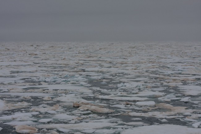
This year’s sea ice was thicker than in the last 10 years and as it turned out most of the flotilla could not enter the 2014 designated North Search Zone in Victoria Strait due to the ice. Serendipitously, our focus shifted south, with two of the platforms staying in the South Search Zone located in the Queen Maud Gulf which had been the site of the 2008 – 2013 expeditions where a land archaeologist found two pieces of iron with clear Royal Navy markings on them. With this information the Investigator searched the area offshore and located the ship, arguably one of the most significant archaeological finds since Howard Carter discovered King Tut in 1922.

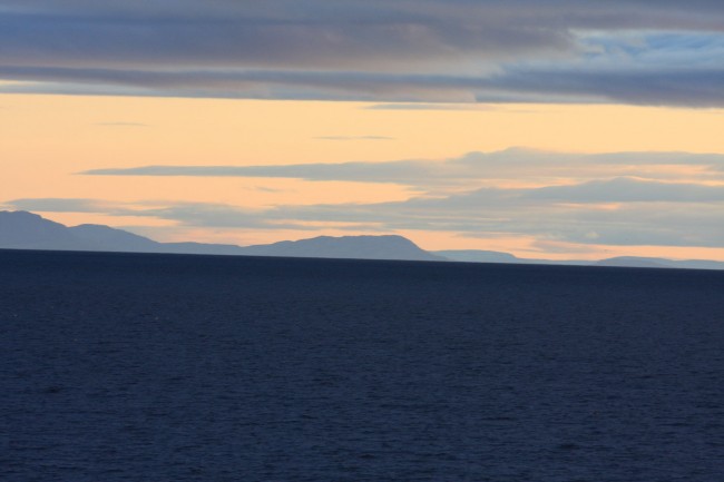
Annual sea ice with brown algae. The weather changed constantly
during the expedition from thick fog to blue, sunny skies.
Locating this ship is a testament to the professionalism of Canadian underwater and land archaeologists, showing the world that our field scientists are among the best. The data gleaned from this expedition will be compiled into educational packages and distributed to 11,500 geography teachers across Canada by The Royal Canadian Geographical Society.
As of writing the ship has yet to be publicly identified as either the Erebus or Terror.
Further reading:
UofTMagazine – A Polar Mystery Solved
CBC Interview – Franklin ship discovery just the ‘beginning’
Photo Credits
All photos by Joseph Frey – All Rights Reserved


Joe, your photographs are amazing. Thanks for sharing the experience of this major breakthrough in Canadian archeology.